EarthEngine Timelapse: tool for inspecting Landsat time-series
Monday 5 March 2018 |
Category: GIS
It’s that time of year again when Masters’ and Undergraduate students must make their decision of what to research for their dissertations.
We therefore thought it a good time to highlight Google’s incredible EarthEngine Timelapse as a tool to help visually inspect potential study areas.
Timelapse example of the Nam Theun 2 hydropower project in Lao PDR (interactive!)
See additional example at bottom of page
The tool creates an annual composite for each year from 1984, with more modern imagery also making use of the higher-resolution Sentinel-2. The tool can also be used to embed interactive frames on websites, such as the example above.
You can use the search box on the top left of their website to navigate to your area of interest. Alternatively, if you knew the decimal coordinates, you can create your own link my changing the latitude and longitude below. The example below navigates to N17.74°, E105.15° and a zoom level of 10 (larger numbers indicating zooming further in). For South or West coordinates, simply put a – before the decimal degrees.
https://earthengine.google.com/timelapse/#v=17.74,105.15,10,latLng
Note however that Landsat imagery exists before 1984; coarse resolution/60m Landsat MSS satellites extending back to 1972, whilst the more standard Landsat TM satellite imagery (both in terms of spectral bands and 30m resolution) exists from 1982.
Though the tool is brilliant for quickly inspecting (predominantly) Landsat time-series imagery, we did notice some cloud detection and masking issues. When using Google EarthEngine ourselves, we often resort to using median pixel values in order to remove the influence of clouds, shadows, and/or more general glitches. Rather frustratingly, CREATE Lab (the creators of the Timelapse tool) curiously appear not to have used this nifty trick.
Nevertheless, the tool is now our go-to option for quickly inspecting and sharing historical landscape-level change. Thanks Google & CREATE Lab!
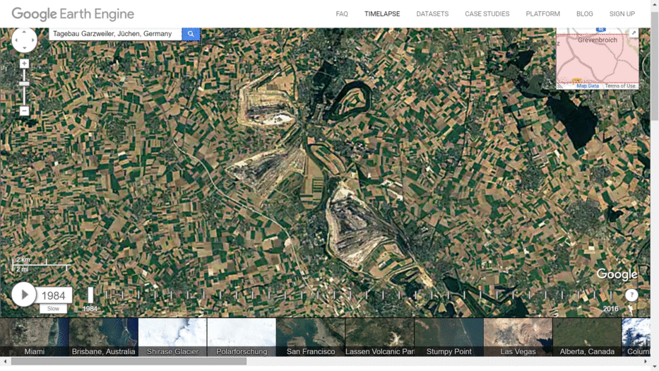
GIF example of the Tagebau lignite mines in Germany: